![]()
Background
The Elk Hollow Mitigation Bank is a wetland and stream mitigation site on a 48-acre area near Edgewood, Iowa. The project’s goal was to create a compensatory mitigation bank where public agencies and private developers could purchase mitigation credits to offset construction impacts to wetlands and waters of the United States. This goal was based on four objectives:
- Offering efficient, flexible mitigation opportunities.
- Removing row crop production and creating floodplain wetlands to improve flood retention, reduce downstream flood impacts, and improve capture during high-flow events.
- Supporting the national goal of no net loss of wetlands.
- Enhancing and creating additional wildlife and aquatic habitat.
As part of the Turkey River Watershed (TRW) headwater system, the bank will provide positive downstream improvements through increased flood attenuation, additional land and water habitats, and improved water quality. In two separate studies, the TRW was identified by the Iowa Department of Natural Resources (DNR) as the highest nitrogen and sediment contributor per square mile of watershed to the Mississippi River during flood events and the fourth highest contributor of sediment under normal flow conditions.
Approach
The design of Elk Hollow focused on restoring and enhancing emergent, farmed, and forested wetlands. Proposed work included eliminating agricultural production, ponding water to increase hydrology, treating invasive species with herbicide, seeding with native vegetation, and planting trees. Forested wetland restoration improved hydrology and established water-friendly trees and vegetation in roughly 3 acres of seasonally saturated soils.
Additionally, 9 acres of emergent and more than 11 acres of forested wetland buffers were improved by removing row crop and pasture production and seeding to promote diversity of native species. Stream buffers filter nutrients and improve water quality. In agricultural landscapes, buffers provide physical, chemical, and biological filters during precipitation and flood events. Increasing the diversity of native grasses and flowering plants created a deep-rooted system that reduces erosion, decreases pollution, and attracts pollinators to the area.
Creation of a berm along the south edge of the area helped restore hydrology to the wetland basin. Varying the berm height with existing topography created different zones of soil saturation and seasonal water depths. This undulating ground surface encourages development of diverse types of emergent plants, or plants rooted in the water with leaves above the surface.
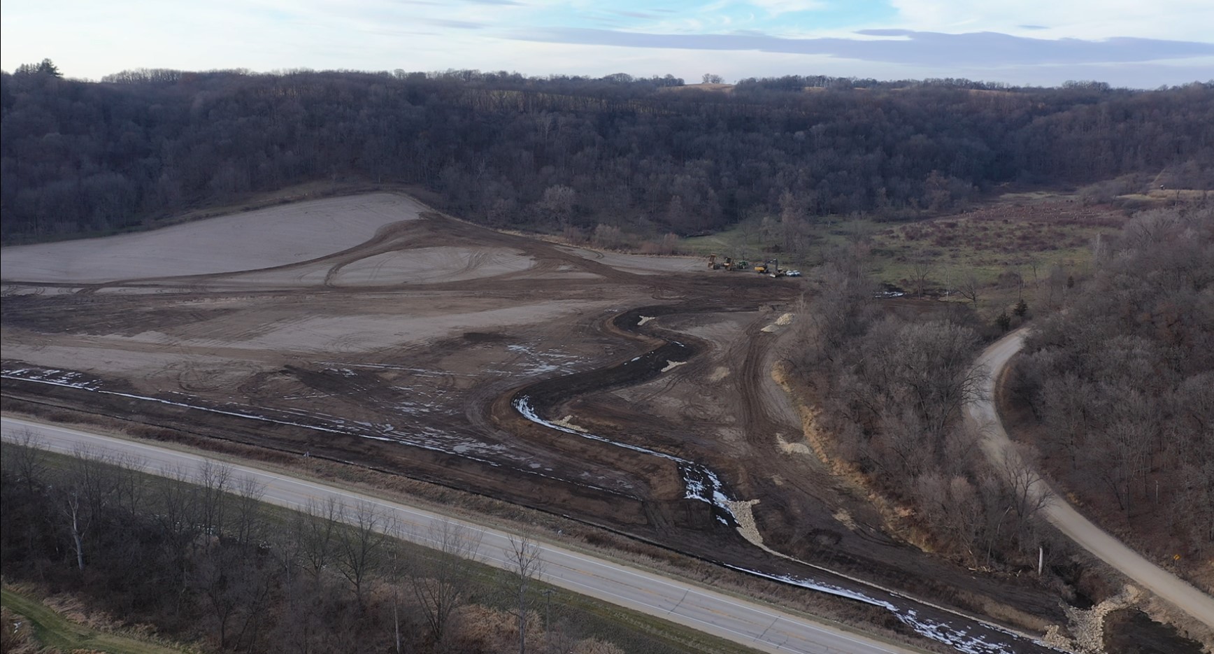
In addition to wetland restoration and enhancement, over 2,500 feet of an unnamed tributary of Elk Creek were realigned and reconnected with the natural floodplain. Other restoration activities included restoring native riparian buffers and installing riffle/pool structures in the stream.
Results
Upon completion of the Elk Hollow Mitigation Bank, the unnamed tributary to Elk Creek will have floodplain wetlands, riffle/pool complexes, and emergent and forested wetlands. The Elk Hollow Mitigation Bank will generate 30,705 stream mitigation credits and 17.82 wetland mitigation credits.
Markets:
Services: Environmental and Regulatory Services
Related Projects
![]()
![]()
![]()
![]()
![]()