![]()
Background
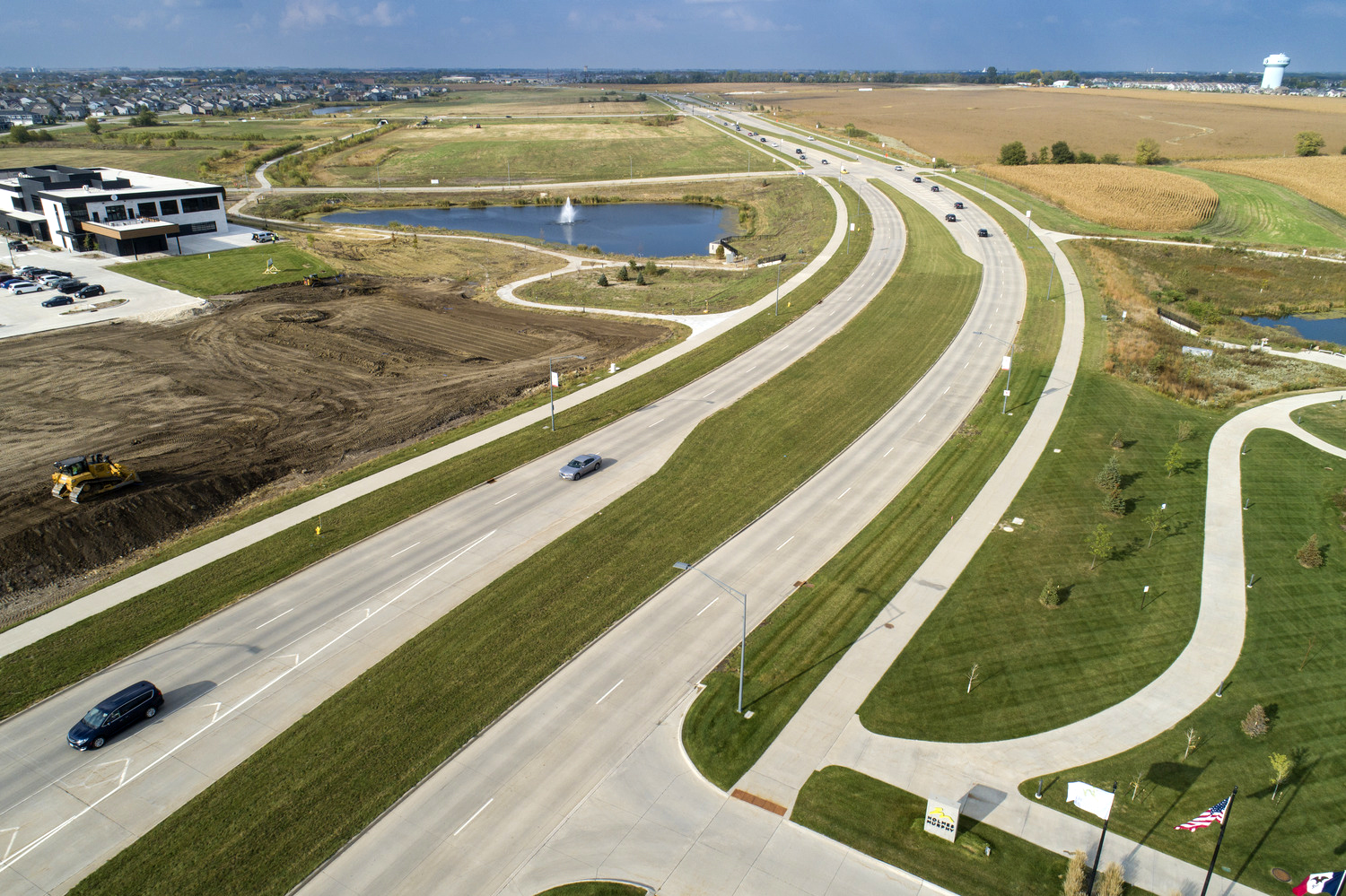
The City of Waukee, Iowa, located about 15 miles west of Des Moines, was experiencing rapid growth and had become the fastest growing community in Iowa. For years, a popular thoroughfare called Alice’s Road corridor had been a top priority for the city to improve safety, relieve congestion, and allow for greater economic development. With more than 1,700 acres of land and access to a future Interstate 80 interchange, the corridor offered the city an opportunity to invest in the economic sustainability of the region and create new industry and job growth.
The need to expand the corridor to ease increased traffic flow was clear. But early modeling uncovered a surprise in the data. Traffic counts were expected to exceed the planned expansion in a matter of years, requiring additional construction to continue supporting anticipated growth.
This is the story of how one city transformed its present and future by taking a risk, trusting the data, and finding alignment with a strategic partner.
Approach
City and community leaders had long recognized the economic development potential of the area. They also were aware of the challenges of their growing community, including existing traffic congestion on Alice’s Road, and lack of an exit from Interstate 80 limited that potential.
The existing road was struggling to accommodate current traffic patterns – often backing up two miles or more during the busiest times. With the number of vehicles expected to increase due to business and residential growth, and a new interchange with I-80, city leaders made it a top priority to relieve the congestion and set the stage for future development.
When Foth came on board, city staff had developed general plans to construct a road and create three usable lanes with the potential to grow to six (i.e., a 3-of-6 design). They also envisioned developing the surrounding area to accommodate residential, commercial, and recreational growth. The new road connecting the area to I-80 was dubbed the Grand Prairie Parkway and the development was branded Kettlestone.
Trusting the Data
Having previously partnered with the city on various short-term projects, the teams already shared a level of trust and confidence.
City leaders knew the I-80 interchange opened the door to the residential and commercial development they envisioned, and they trusted us to help bring their vision to life. Construction of an urban road was the first step in that journey.
Using Vistro, a cutting-edge traffic-modeling application, traffic patterns and potential scenarios were generated. This allowed our team to determine that although the 3-of-6 highway design would suffice, it wouldn’t provide a sustainable long-term solution to forecasted economic growth. As suggested by our model, a 4-of-6 design would not only be more effective in improving current traffic flow, but also be easily adjusted to accommodate anticipated growth.
While the new model revealed what the team considered a clear path forward, they acknowledged its effects on water management, lighting, side roads, interchanges, environmental impacts, and increased traffic along property lines. Drawing from previous experience, our team knew that adjustments to budget and timeline could ultimately present challenges to stakeholder buy-in.
Taking a Risk
In addition to the new road design, the team took a regional perspective and recommended three changes to other aspects of the original plan. Although this perspective would require more infrastructure, it would simplify future development.
- Develop a system of stormwater ponds to manage the run-off predicted by the models
- Create a joint utility trench with enough conduits to accommodate current needs and future growth
- Square off lot lines so that roads can be placed on those lines, which equally distributes costs between landowners, and prevents property owners from being left with remnant pieces of land
For city leaders, it came down to trust in Foth and the data provided. The recommendation was initially, albeit cordially challenged, then validated and the project moved forward as proposed.
Building Consensus
The new plan required support from elected leaders and cooperation of property owners along the project route. To build consensus, we immediately engaged with stakeholders. While not everyone agreed with the new plan, they appreciated being heard. Property owners understood how they would be affected and that they would receive market value for their properties.
Elected leaders were also grateful for background discussions between our team and city staff. Drawing from their understanding of the approach and data, they were better able to respond to constituents’ questions and concerns and promote the benefits. The political challenges of projects like this are often as significant as the engineering challenges, so we prepared for both.
Services Provided
- Traffic modeling
- Traffic signal design
- Trails and bikeways
- Public involvement and coordination
- 3D modeling and staking
- Stormwater quality and modeling
- Urban roadway design
- Grants and funding assistance
- Environmental compliance
- Bidding and contract administration
- Water main design
- Utility planning
Results
A Transformed Community, A Stronger Relationship
When it opened, Grand Prairie Parkway handled nearly three times as much traffic as the Alice’s Road, which accommodated about 4,000 vehicles per day. The first day the new parkway opened, it served more than 12,000 vehicles, just as the models predicted.
Most importantly, the improved traffic flow enabled the volume of residential and commercial growth the city leaders envisioned. The urban roadway now handles about 15,000 vehicles per day, in keeping with predictions. It supplies a constant flow of traffic through the Kettlestone corridor, which boasts a mix of single-family and multi-family residences, recreation spaces, retail shops, entertainment venues, and commercial businesses. It has helped transform Waukee into a destination all its own and strengthened the relationship between Foth and the city.
By the Numbers
- Traffic increase: from 4,000 to 15,000 vehicles per day
- Miles of road: 2.85
- Acres of land: 1,700
- Property owners impacted: 36
- Agencies involved: FHWA, DOT, USACE, laDNR, Union Pacific Railroad and Des Mones MPO
Markets: Departments of Transportation, Municipalities
Services: Strategic Consulting and Planning, Transportation
Related Projects


![]()
![]()
![]()
![]()
![]()