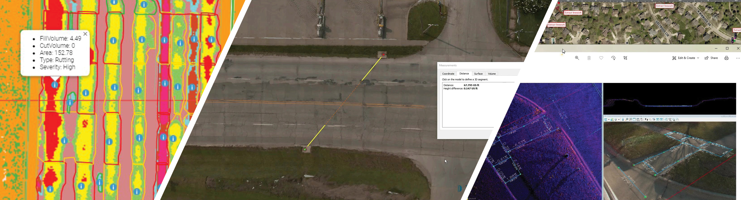
 Pavement Condition Index
Utilizing Riegl’s VMX-2HA Mobile LiDAR Scanner, with dual rear downward facing cameras and laser measurement sensors, our team is able to:
- Generate precise, high-resolution pavement surface modeling in a fraction of the time compared to if collected manually
- Adhere to ASTM standards to provide metric quality data and reporting – supported by visualized point cloud data for pavement analysis and classification
- Prioritization of maintenance programs based on severity and traffic volume
 Asset Management
To counter common operational challenges with asset management, such as location or proximity and quality of entities such as roads, bridges, utilities, etc., our MLS system collects color imagery with dense, detailed point cloud data for easy extraction into CAD. Having digital documentation of the following can not only prove beneficial for current or future reference, but can also limit repeated field visits often encountered with use of traditional methods.
- Clearance measurements
- Condition monitoring
- Growth planning requirements
 ADA Compliance
The Americans with Disabilities Act has motivated public agencies to better adhere to Federal standards. Utilizing data from the MLS system, we can:
- Efficiently convert point cloud data into user friendly formats to identify compliant and non-compliant issues
- Collect data that is just as accurate, if not better, than that collected by traditional means
- Identify outdated ramps, lack of truncated domes, running and transverse slope calculations, and the severity of defects, as well as other parameters
- Incorporate the information into client ADA Transition Plans and Capital Improvement Programs
 3D Surface Models/Topography
As a proven technology for safely acquiring data of complex corridors, roadways or interchanges, our MLS system has the ability to capture miles of information while avoiding the limitations and expense of road closures often encountered through use of traditional methodology. In a fraction of the time, data can be collected and delivered in a traditional, accurate CAD model.