![]()
While the concept behind LiDAR scanning has been in existence for more than 50 years, technological advancements are expanding the ways in which it can be used. Mobile LiDAR Scanning, or MLS – a system typically mounted on a truck, Utility Terrain Vehicle, or boat – is increasingly adding value in capturing data for infrastructure projects through enhanced safety, speed, and efficiency.
These technology developments make MLS ideal for projects that require efficient and accurate 3D topographic data capture over large areas, from city streets and railways to waterways and highways. With this expansion of applications, Foth invested in an MLS system — the RIEGL VMX-2HA — to provide clients with richer data.
Benefits of Mobile LiDAR Scanning
Because MLS can efficiently collect data and imagery, it is especially suited for projects that span a long and linear space, such as highways, city streets, multi-level roadways, railroad corridors, tunnels, airport infrastructure, and utility transmission line corridors. MLS can also be used in building and inspecting bridges, planning for parking allocations, designing urban spaces, and examining areas of traffic congestion.
When it comes to using MLS for your next project, the benefits range from improved safety, quick and accurate data capture, flexibility, future capabilities, and more.
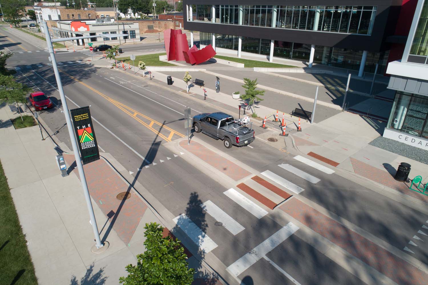
- Safety and Schedule: Foth deployed its MLS system for a project in Iowa City, IA. Court Street is a narrow, high-traffic urban corridor and an important collector street connecting the east side of Iowa City to the downtown area. Reconstruction of the roadway will replace aging street and sidewalk pavement and upgrade public utilities. MLS proved invaluable in improving the safety of field personnel, reducing traffic delays, and adhering to an aggressive project schedule. Foth collected data pertaining to roadway features, residential driveways, retaining walls, sidewalks, overhead utilities, trees, and traffic signals within a single day.
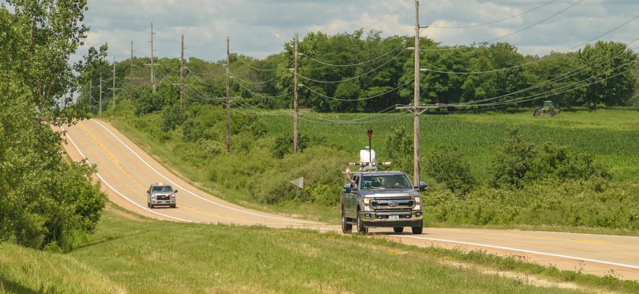
- Flexibility and Future Capabilities: Grand Prairie Parkway in West Des Moines, IA will eventually be a continuous roadway connecting two main thoroughfares and providing the necessary infrastructure to spur redevelopment in the area. With two new data centers in the works, the City of West Des Moines initiated a $84-million project including a new railroad bridge, realignment of an existing waterway, and establishing a utility corridor. Foth used its MLS capabilities to acquire the necessary design data quickly, accurately, and safely. The Foth team also took the MLS system off-road to gather additional data required, including the amount and caliper of trees to be cleared from the project site, and scanned the surrounding environment to develop 3D models for potential future design needs.
How It Works
The MLS equipment Foth uses has two highly accurate LiDAR sensors and up to nine cameras can be configured to capture the needed data for each job. When the system is operating, the high laser pulse repetition rate of up to 2 MHz helps produce two million measurements and 500 scan lines per second. Data is collected up to 420 meters away with a 360-degree field of view. A smart geo-fence tool and restricting distance measurements enable the right area of coverage to be obtained, both to optimize collecting the data and extracting it in the office. This capability, paired together with the downward and outward facing digital camera sensors, provides detailed images of road surface and makes MLS highly suited for tasks like pavement analysis or crack indexing.
Back at the office, the data captured creates a point cloud dataset that can be processed to the level required for each project. Foth uses numerous software tools to view the raw data, load sections of the point cloud for collaborative work, and extract the necessary data for specific project deliverables. In addition, terrestrial survey files can be seamlessly merged with those from mobile scanning, providing a flexible way of enhancing accuracy when required by the project.
MLS Serves You Today and Tomorrow
Because Foth’s MLS system collects billions of data points during the scanning process, it can serve as a digital databank. Proactive scanning of public city infrastructure creates a point cloud where different levels of information can be extracted as needed without doing additional surveys.
Municipalities will also find value in using MLS to help create Pavement Condition Index reports and quickly determine sidewalk ramps to comply with the Americans with Disabilities Act, as well as catalogue an inventory of assets, and develop management plans. Projects with a public engagement component also benefit, as MLS data can be used to generate visualizations and animations that help create excitement and community support.
Many more applications are possible and the list will keep expanding as the technology continues to develop. Contact us today to find out how MLS can best serve you on your next infrastructure project.
Markets: DOTs, Municipalities
Services: Geospatial and Geophysical, Transportation Services
Related Insights


![]()
![]()
![]()
![]()
![]()