![]()
“The value added to data collection accuracy when utilizing MLS methods is paramount. And when paired with safety and efficiency improvements, as well as impact to sustainability and resiliency goals, it becomes the ideal method to combine with traditional survey techniques.”
Jon Miranda, Lead Geospatial Specialist

Partnering with Roads & Bridges Media, Jon Miranda and contributors Dave Overman and Ben Sullivan share their experience and insight using Mobile LiDAR technology.
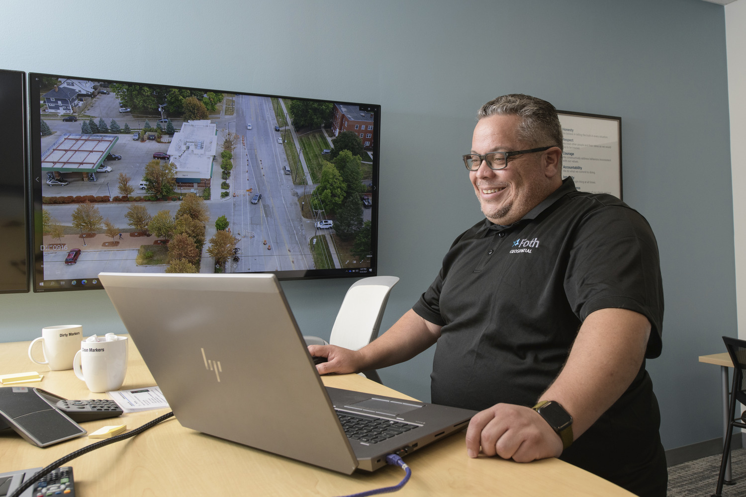
Jon combines more than 20 years of professional geographic science experience with his passion to leverage technology in ways that benefit both fellow colleagues and clients. As a lead geospatial specialist and Unmanned Aerial System (UAS) pilot, Jon’s technical experience includes LiDAR data collection and processing, automated UAS planning and processing, quality control and assurance of completed surveying, drafting and cartography, digital terrain modeling, GPS control survey planning and validation, and hydrographic surveys. He continues to embrace the fusion of creativity and mechanical skills to provide and communicate unique, effective solutions.
Read a snippet Jon’s insights on data collection quality improvements through LiDAR.
Digitally Mapping Cities
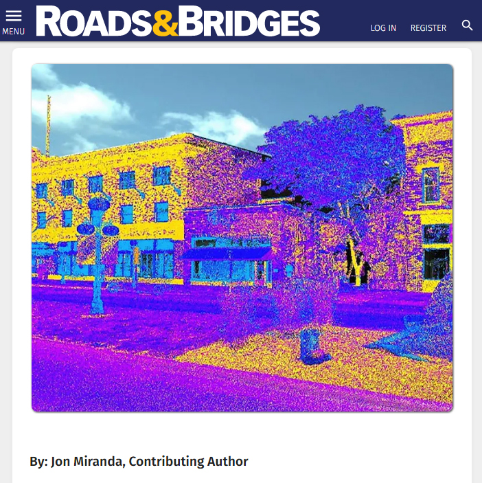
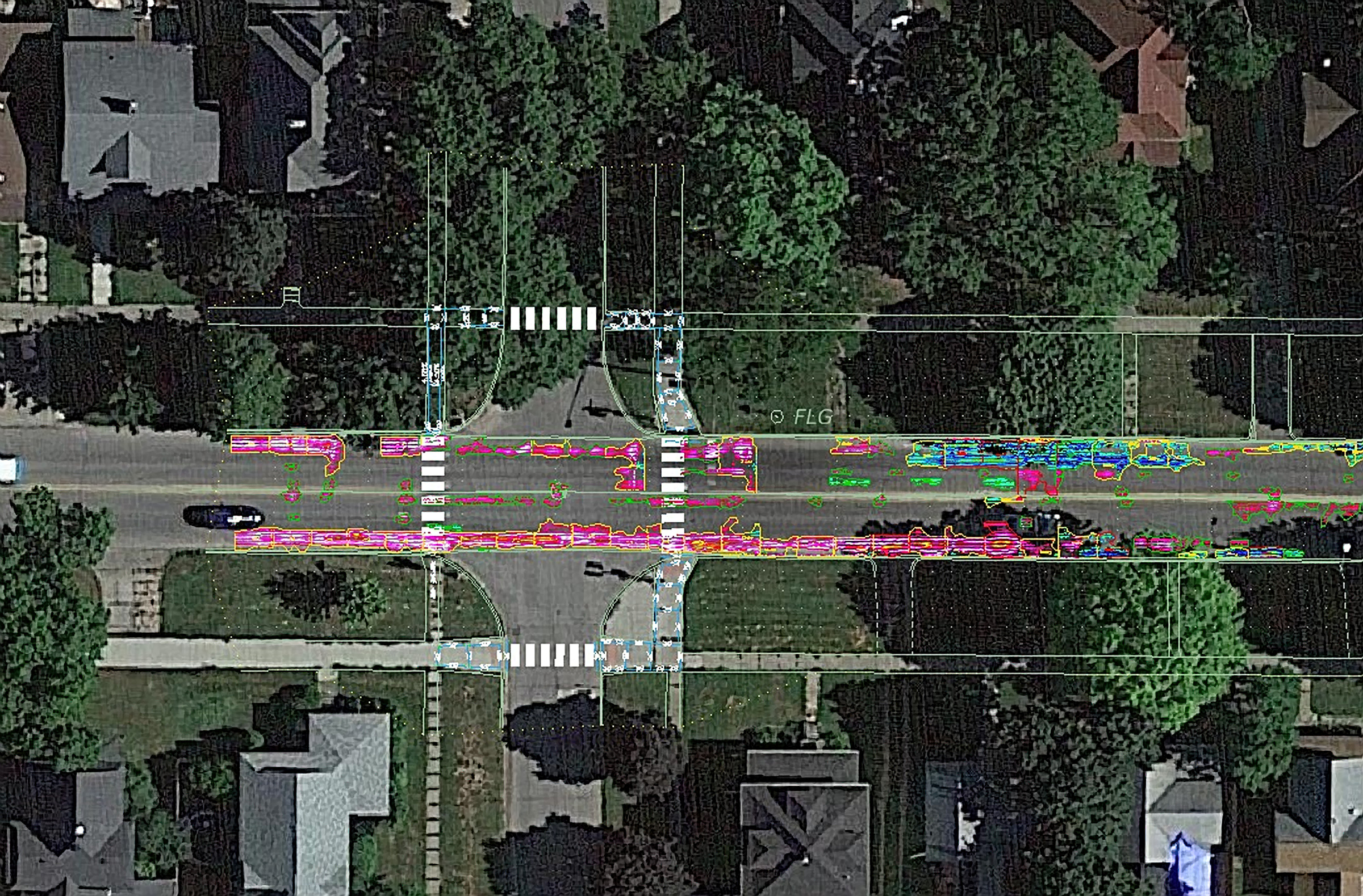
Mobile light detection and ranging (LiDAR) scanning technology contributes to increased efficiency, safety, and return on investment. It also offers improvements that align with the federal standards for accessible design, as well as growth opportunities, transportation needs, or future goals such as autonomous driving.
This technology’s flexibility allows for utilization of a Mobile LiDAR System (MLS) and an overall improvement in the quality and management of data collected along transportation networks. It gives cities the opportunity to collect perpetual data while improving field personnel safety, reducing traffic delays, and adhering to aggressive project schedules. Across the nation, this technology draws upon digital mapping to create highly detailed and accurate 3D digital twins of city roadways, highways, buildings, and more.
Behind the Technology
An MLS scanner is commonly mounted on a truck or SUV. When fit to an all-terrain vehicle (ATV) or boat, the scanner can add diversification of the environmental data obtained. Featuring up to nine cameras that collect data omnidirectionally across approximately 1,300 lateral feet, the scanner captures millions of data points per second with thousands of panoramic and directional view photos.
Learn how the City of Perry, Iowa capitalized their data using MLS.
Related News and Events
Foth Expands Capabilities in the Food Manufacturing Sector with Acquisition of Food Plant Engineering
![]()
![]()
![]()
![]()
![]()