![]()
Background
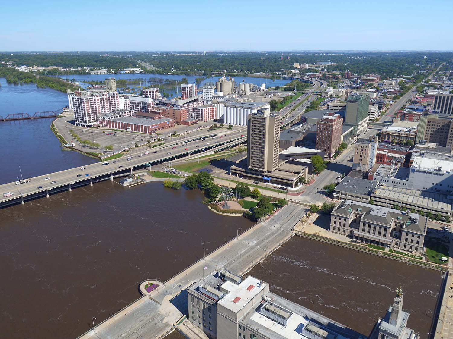
In an attempt to minimize devastation caused by reoccurring flooding, the City of Cedar Rapids developed a 20-year, $663M project providing permanent and removable flood walls, levees, and gates along the banks of the Cedar River. Spanning nearly seven miles, the Cedar River Flood Control System (CRFCS) required Foth to complete the complex tasks of acquiring railway pier features for hydraulic modeling at a site only accessibly by boat and capturing topographic survey data at a location only accessible for four hours.
Approach
At the first site, our team utilized traditional techniques, such as total stations and scanning equipment, to capture data along the bank. Faced with limited time, the team determined a single instrument was needed to integrate total station measurements with high-speed, georeferenced 3D scans. A two-person crew launched a motor boat adorned with a Trimble R10 GNSS rover, SX10, Trimble Yuma, 2 tablets and a Trimble TSC3 controller was used to capture railroad track locations as well as pier shape and size. Control points were established in nine locations with all sections being georeferenced. Over a two day period, the team scanned various railroad tracks and 12 piers, captured colored photography, and collected 11.8M 3D points used to deliver a 3D point cloud for engineering design.
For the second site, our team collected topographic survey as well as as-built data of ground-level and submerged infrastructure. For the first time in history, the City closed the dam in downtown Cedar Rapids, providing us four hours to scan the entire length of the west bank. With 10 control points set, features up to 245 miles away were captured and more than 27.6M points of data collected.
Results
Without the innovative use of technology, more than three times as many man hours would have been required, and only 20 percent of data obtained. Through the precision and detail of our team’s services, a misunderstanding in the assumed vertical clearance low point was revealed. Ultimately, this not only supported the success of the SX10 scanning debut, but saved the City from various costly mistakes.


Markets: Municipalities
Services: Geospatial and Geophysical
Related Projects


![]()
![]()
![]()
![]()
![]()